Institut für Geodäsie und Geoinformation (IGG): Institut für Geodäsie und Geoinformation (IGG): Recent submissions
Now showing items 41-60 of 105
-
Entwicklung einer direkten Georeferenzierungseinheit zur Positionsund Orientierungsbestimmung leichter UAVs in Echtzeit
(2016)Seit einigen Jahren werden im Bereich der Geodäsie immer häufiger auch Unmanned Aerial Vehicles (UAVs) als kinematische Trägerplattformen eingesetzt. Dazu werden diese mit objekterfassender Sensorik, wie z.B. Digitalkameras ... -
Methods for assimilating remotelysensed water storage changes into hydrological models
(2016)Understanding physical processes within the water cycle is a challenging issue that requires merging information from various disciplines. The Gravity Recovery And Climate Experiment (GRACE) mission provides a unique ... -
Analyse der Konfiguration bei der Approximation ungleichmäßig abgetasteter Oberflächen auf Basis von Nivellements und terrestrischen Laserscans
(2015)Seit einigen Jahren unterliegt der Bereich der Ingenieurgeodäsie einem starken Wandel, da sich diese Disziplin generell den stetig weiterentwickelnden, anwendungsbezogenen Problemstellungen widmet. Unter diesen Aspekten ... -
Convex optimization for inequality constrained adjustment problems
(2015)Whenever a certain function shall be minimized (e.g., a sum of squared residuals) or maximized (e.g., profit) optimization methods are applied. If in addition prior knowledge about some of the parameters can be expressed ... -
On high performance computing in geodesy: applications in global gravity field determination
(2015)Autonomously working sensor platforms deliver an increasing amount of precise data sets, which are often usable in geodetic applications. Due to the volume and quality, models determined from the data can be parameterized ... -
The application of impact factors to scheduling VLBI Intensive sessions with twin telescopes
(2015)This thesis deals with the scheduling of special purpose, 1h-long VLBI sessions, so-called Intensives, and its further extension by twin radio telescopes. The daily VLBI Intensive measurements make an important contribution ... -
Determination of sub-daily earth rotation parameters from VLBI observations
(2015)The work presented deals with the determination of sub-daily Earth Rotation Parameters (ERPs) from Very Long Baseline Interferometry (VLBI) observations. Monitoring and interpreting the Earth's rotation variations in general ... -
Retrieval of sea level and surface loading variations from geodetic observations and model simulations: an integrated approach
(2015)The mass distribution in the system Earth changes dynamically over time. Time-variable mass transport mainly arises from the interplay between the terrestrial hydrological water cycle, the ocean and atmosphere, and the ... -
Potentiale von Laserscannern zur Phänotypisierung von Pflanzen für den Einsatz im Hochdurchsatz-Screening
(2017)<td>Die Züchtung hochertragreicher Pflanzen ist von essentieller Wichtigkeit für die Ernährung der Weltbevölkerung. Diese Züchtung geht einher mit einer genauen Analyse der Interaktion zwischen pflanzlichem Genom und ... -
Proceedings of the First International Workshop on VLBI Observations of Near-field Targets, October 5-6, 2016
(2017)Diese Veröffentlichung erscheint anlässlich des First International Workshop on VLBI Observations of Near-field Targets, der am 4 - 5. Oktober 2016 im Institut für Geodäsie und Geoinformation stattfand. First International ... -
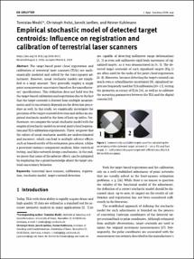
Empirical stochastic model of detected target centroids: Influence on registration and calibration of terrestrial laser scanners
(2019-03-22)The target-based point cloud registration and calibration of terrestrial laser scanners (TLSs) are mathematically modeled and solved by the least-squares adjustment. However, usual stochastic models are simplified to a ... -
Statistical signal decomposition techniques for analyzing time-variable satellite gravimetry data
(2014)The time-variable gravity fields from the Gravity Recovery and Climate Experiment (GRACE) satellite mission provide valuable information about total water storage variations on a global scale. This quantity is difficult ... -
Lebensbilder im Wandel der preußischen Verwaltung des 19. und 20. Jahrhunderts: Eine Sammlung biographischer Miniaturen
(2014)Diese Schrift erscheint anlässlich des 75. Geburtstages von Prof. Dr.-Ing. Dr. h.c. mult. Erich Weiß am 13. September 2014. Am 13.9.2014 konnte Erich Weiß seinen 75. Geburtstag feiern. Anlass genug, Rückschau auf ... -
Assessing people´s early warning response capability to inform urban planning interventions to reduce vulnerability to tsunamis: case study of Padang City, Indonesia
(2014)In the last decade, more emphasis is given on the human aspect of early warning or the attribute of “people-centered” early warning systems. This study seeks to better understand the specific conditions that shape people´s ... -
Entwicklungsperspektiven metropolitaner Peripherien im Rahmen stadtregionaler Planungs- und Entwicklungsprozesse am Beispiel Nordrhein-Westfalen
(2013)Die zurückliegenden Dekaden haben sich durch eine enorme Zunahme der Entwicklungsdynamiken von gesellschaftlichen, ökonomischen und ökologischen und daraus hervorgehend räumlichen Entwicklungen charakterisiert. Ein prägnantes ... -
Socio-environmental impacts of settlement growth under conditions of fostered infill development: A methodological framework for a multicriteria assessment
(2013)The major objective of this study is to analyze socio-environmental conditions under which a sustainable and resource-preserving settlement development can be promoted and to assess respective impacts of greenfield and ... -
Sequential learning using incremental import vector machines for semantic segmentation
(2013)We propose an innovative machine learning algorithm called incremental import vector machines that is used for classification purposes. The classifier is specifically designed for the task of sequential learning, in which ... -
Hierarchical and spatial structures for interpreting images of man-made scenes using graphical models
(2013)The task of semantic scene interpretation is to label the regions of an image and their relations into meaningful classes. Such task is a key ingredient to many computer vision applications, including object recognition, ... -
Automatische Detektion von Krankheiten auf Blättern von Nutzpflanzen
(2013)In dieser Arbeit wird ein neuartiges, automatisches Verfahren zur Detektion von Krankheiten auf Blättern von Nutzpflanzen vorgestellt. Die Anwendung von Mustererkennungsverfahren zur Detektion von Blattkrankheiten ist noch ... -
Ein hierarchischer Ansatz zur Interpration von Gebäudeaufnahmen
(2013)Durch die Fortschritte bei der 3D-Visualisierung von Landschaften und urbanen Räumen in den vergangenen Jahren wächst die Nachfrage nach semantischen und detailgenauen 3D-Stadtmodellen. Die Interpretation von Digitalbildern ...