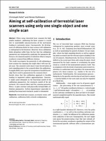
Aiming at self-calibration of terrestrial laser scanners using only one single object and one single scan

Aiming at self-calibration of terrestrial laser scanners using only one single object and one single scan

| dc.contributor.author | Holst, Christoph | |
| dc.contributor.author | Kuhlmann, Heiner | |
| dc.date.accessioned | 2020-05-07T10:20:45Z | |
| dc.date.available | 2020-05-07T10:20:45Z | |
| dc.date.issued | 05.12.2014 | |
| dc.identifier.uri | https://hdl.handle.net/20.500.11811/8365 | |
| dc.description.abstract | When using terrestrial laser scanners for high quality analyses, calibrating the laser scanner is crucial due to unavoidable misconstruction of the instrument leading to systematic errors. Consequently, the development of calibration fields for laser scanner self-calibration is widespread in the literature. However, these calibration fields altogether suffer from the fact that the calibration parameters are estimated by analyzing the parameter differences of a limited number of substitute objects (targets or planes) scanned from different stations.
This study investigates the potential of self-calibrating a laser scanner by scanning one single object with one single scan. This concept is new since it uses the deviation of each sampling point to the scanned object for calibration. Its applicability rests upon the integration of model knowledge that is used to parameterize the scanned object. Results show that this calibration approach is feasible leading to improved surface approximations. However, it makes great demands on the functional model of the calibration parameters, the stochastic model of the adjustment, the scanned object and the scanning geometry. Hence, to gain constant and physically interpretable calibration parameters, further improvement especially regarding functional and stochastic model is demanded. | en |
| dc.format.extent | 16 | |
| dc.language.iso | eng | |
| dc.rights | In Copyright | |
| dc.rights.uri | http://rightsstatements.org/vocab/InC/1.0/ | |
| dc.subject | terrestrial laser scanner | |
| dc.subject | systematic errors | |
| dc.subject | selfcalibration | |
| dc.subject | calibration eld | |
| dc.subject | network con guration | |
| dc.subject.ddc | 526.1 Geodäsie | |
| dc.title | Aiming at self-calibration of terrestrial laser scanners using only one single object and one single scan | |
| dc.type | Wissenschaftlicher Artikel | |
| dc.publisher.name | de Gruyter | |
| dc.publisher.location | Berlin | |
| dc.rights.accessRights | openAccess | |
| dcterms.bibliographicCitation.volume | 8 | |
| dcterms.bibliographicCitation.issue | 4 | |
| dcterms.bibliographicCitation.pagestart | 295 | |
| dcterms.bibliographicCitation.pageend | 310 | |
| dc.relation.doi | https://doi.org/10.1515/jag-2014-0017 | |
| dcterms.bibliographicCitation.journaltitle | Journal of Applied Geodesy | |
| ulbbn.pubtype | Zweitveröffentlichung | |
| dc.version | publishedVersion |
Files in this item
This item appears in the following Collection(s)
-
Publikationen (29)


