eDissertationen: Search
Now showing items 1-10 of 10
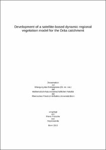
Development of a satellite-based dynamic regional vegetation model for the Drâa catchment
(2011-02-07)
Analysing and modelling land cover dynamic of the vegetation under a changing hydrological cycle inside the semi-arid area resulting from the global climate change are a difficult task. It is important to be able to ...
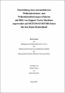
Entwicklung eines automatisierten Wolkendetektions- und Wolkenklassifizierungsverfahrens mit Hilfe von Support Vector Machines angewendet auf METEOSAT-SEVIRI-Daten für den Raum Deutschland
(2013-03-20)
Wolken stellen im Klimasystem der Erde einen zentralen Faktor dar, nicht nur in Bezug auf die Niederschlagsverteilung, sondern auch in Verbindung mit Effekten auf Strahlungsvorgänge innerhalb der Atmosphäre. Eine genaue ...
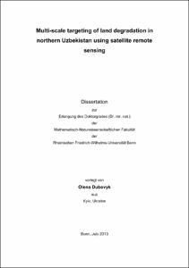
Multi-scale targeting of land degradation in northern Uzbekistan using satellite remote sensing
(2013-11-13)
Advancing land degradation (LD) in the irrigated agro-ecosystems of Uzbekistan hinders sustainable development of this predominantly agricultural country. Until now, only sparse and out-of-date information on current land ...
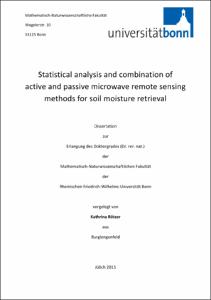
Statistical analysis and combination of active and passive microwave remote sensing methods for soil moisture retrieval
(2016-08-15)
Knowledge about soil moisture and its spatio-temporal dynamics is essential for the improvement of climate and hydrological modeling, including drought and flood monitoring and forecasting, as well as weather forecasting ...
Multiseasonal Remote Sensing of Vegetation with One-Class Classification – Possibilities and Limitations in Detecting Habitats of Nature Conservation Value
(2017-07-03)
Mapping of habitats relevant for nature conservation often involves the identification of patches of target habitats in a complex mosaic of vegetation types extraneous for conservation planning. In field surveys, this is ...
Evaluating the Contribution of Remote Sensing Data Products for Regional Simulations of Hydrological Processes in West Africa using a Multi-Model Ensemble
(2019-05-02)
Water is a crucial resource for human health, agricultural production and economic development. This holds especially true in West Africa, where large parts of the population work as self-sustaining farmers. Accurate knowledge of available water resources is therefore essential to properly manage this valuable commodity. Hydrologic modeling is seen as a key aspect in generating predictions of available resources. However, the overall availability of in situ data for model parametrization in West Africa has been steadily declining since the 1990s. When observations are available, they often contain errors and gaps. This lack of data severely hinders the application of hydrologic models in the region. Nowadays, many global and regional remote sensing and reanalysis data products exist which may be used to overcome these problems. A thorough analysis of the contribution of these products to regional simulations of hydrologic processes in West Africa has so far not been conducted. The purpose of this study is to close this gap. The study area spans from 3 to 24° latitude and -18 to 16° longitude and encompasses, among others, the Niger, Volta, and Senegal river basins. This study focuses on three key aspects, namely how the performance of remotely sensed and reanalyzed products can be validated without the availability of in situ data for the region; to what extent semi-distributed hydrologic models of the region can be parameterized and validated using these data; and how a fully distributed, grid-based model can be set up, calibrated and validated for sparsely-gauged river basins using multivariate data inputs.<br /> Comparisons of remote sensing and reanalysis precipitation products for the region show strong<br /> variability. A hydrologic evaluation was conducted, during which the skill of each precipitation dataset to accurately reproduce observed streamflow in HBV-light simulations was tested. Best results are achieved by products which include satellite infrared and microwave measurements as well as bias-correction based on in situ observations. Averaged Nash-Sutcliffe Efficiencies (NSE) of 0.66 were reached during the calibration of the CMORPH CRT and PERSIANN CDR products over six subbasins.<br /> In a next step, three SWAT models were set up for the region using multiple remote sensing and reanalysis data products and then calibrated and validated against observed river discharge with global and local approaches. While streamflow results differ within models and model regions, they are mostly satisfactory with coefficient of determination (R<sup>2</sup>) values of 0.52 and 0.51 for calibrations and 0.63 and 0.61 for validations. In a multivariate validation framework, the skill of the model in simulating variables not included in the calibration is further evaluated against remote sensing observations of actual evapotranspiration, soil moisture dynamics, and total water storage anomaly. Here, it has been shown that the models perform robustly and reach a good agreement in relation to observations.<br /> Furthermore, the grid-based mHM model was applied to several river basins in the south of the study area. After the quality of precipitation and evapotranspiration inputs was tested, a multivariate calibration was conducted. Models were calibrated using discharge observations<br /> (Q) and, to further constrain model boundary conditions, discharge in combination with remote sensing actual evapotranspiration observations (Q/ET). Finally, the quality of the simulations was tested against streamflow data as well as against remote sensing actual evapotranspiration, soil moisture, and total water storage anomaly data. Streamflow simulations performed well with averaged Kling-Gupta Efficiencies (KGE) of 0.53 for the first (Q) and 0.49 for the second (Q/ET) calibration. Further variables tested during the multiobjective validation were within good predictive ranges, especially during the Q/ET calibration. When SWAT and mHM model results are compared against each other and against external data products, results show that while both models perform robustly, mHM predictions outperform SWAT results.<br /> This study furthers the understanding of the contribution of remote sensing, reanalysis and global data products in regional simulations of hydrologic processes in West Africa. Specific modeling strategies and routines were developed to further increase predictive capabilities of hydrologic models of the region using these freely-available datasets....
Mapping intra- and inter-annual dynamics in wetlands with multispectral, thermal and SAR time series
(2019-10-23)
<strong>Kartierung der intra- und interannuellen Dynamik von Feuchtgebieten mit multispektralen, thermischen und SAR-Zeitreihen</strong><br /> Die Analyse der aktuellen räumlichen Verbreitung und der zeitlichen Entwicklung ...
Suitability Analysis of Satellite Remote Sensing Methods to Map Agricultural Land Use Change after Zimbabwe's "Fast Track Land Reform Programme"
(2017-04-06)
Forced evictions of white commercial farmers in the year 2000 took the Zimbabwean land reform programme to a new level. While international media covered the tragedies of white farmers, the collapse of a state economy and ...
Detecting Plant Functional Traits of Grassland Vegetation Using Spectral Reflectance Measurements
(2018-03-06)
Changes in climate and an intensified agricultural use threaten grassland ecosystems in many places. To allow an efficient conservation of grassland vegetation communities, ecologists monitor variations in their plant ...
Quantifizierung der relativen Meeresspiegelentwicklung entlang der Küsten des Omans
(2019-12-03)
Zentrales Thema dieser Promotion sind die Ursachen und Auswirkungen von Meeresspiegelschwankungen auf die Küste des Omans, welche auf verschiedenen Zeitskalen beleuchtet werden. Anhand der Küstenmorphologie, der Topographie ...