Institut für Geodäsie und Geoinformation (IGG): Auflistung Institut für Geodäsie und Geoinformation (IGG) nach Titel
Anzeige der Dokumente 78-97 von 105
-
Retrieval of sea level and surface loading variations from geodetic observations and model simulations: an integrated approach
(2015)The mass distribution in the system Earth changes dynamically over time. Time-variable mass transport mainly arises from the interplay between the terrestrial hydrological water cycle, the ocean and atmosphere, and the ... -
Robot mapping and navigation in real-world environments
(2020)Robots can perform various tasks, such as mapping hazardous sites, taking part in search-and-rescue scenarios, or delivering goods and people. Robots operating in the real world face many challenges on the way to the ... -
Robust determination of station positions and Earth orientation parameters by VLBI intra-technique combination
(2011)In this thesis, it is shown that combining contributions of different VLBI analysis centers, a so called intratechnique combination, improves the robustness and stability of the final VLBI results. For this purpose, a ... -
Robust Wide-Baseline Stereo Matching for Sparsely Textured Scenes
(2013)The task of wide baseline stereo matching algorithms is to identify corresponding elements in pairs of overlapping images taken from significantly different viewpoints. Such algorithms are a key ingredient to many computer ... -
Sensor fusion for localization of automated vehicles
(2020)Automated vehicles need to precisely know where they are at all times to be able to make informed driving decisions. Therefore, multiple localization systems are typically installed on such vehicles to provide redundant ... -
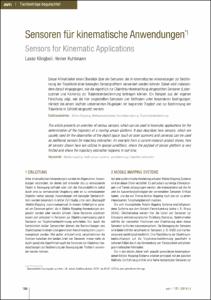
Sensoren für kinematische Anwendungen: Sensors for Kinematic Applications
(2014)Dieser Artikel bietet einen Überblick über die Sensoren, die in kinematischen Anwendungen zur Bestimmung der Trajektorie einer bewegten Sensorplattform verwendet werden können. Dabei wird insbesondere darauf eingegangen, ... -
Separablity of deformations and measurements noises of GPS time series with modified Kalman filter for landslide monitoring in real-time
(2012)The separation of the deformations and measurement noise of GPS coordinate time series and accuracy improvement of GPS real-time coordinates are major aspects of the thesis. In order to reduce the influence of the colored ... -
Sequential learning using incremental import vector machines for semantic segmentation
(2013)We propose an innovative machine learning algorithm called incremental import vector machines that is used for classification purposes. The classifier is specifically designed for the task of sequential learning, in which ... -
Simulated satellite formation flights for detecting the temporal variations of the Earth's gravity field
(2010)In this thesis, the concept of satellite formation flight (SFF) is studied by means of simulated satellite observations. With various formation types enabling inter-satellite measurements in various directions (e.g. ... -
Singular Value Decomposition and Cluster Analysis as Regression Diagnostics Tools in Geodetic VLBI
(2008)It is well known that high-leverage observations significantly affect the estimation of parameters. So far, mainly redundancy numbers have been used for the detection of single high-leverage observations or of single ... -
Socio-environmental impacts of settlement growth under conditions of fostered infill development: A methodological framework for a multicriteria assessment
(2013)The major objective of this study is to analyze socio-environmental conditions under which a sustainable and resource-preserving settlement development can be promoted and to assess respective impacts of greenfield and ... -
Spatio-temporal Correlations of Terrestrial Laser Scanning: Raumzeitliche Korrelationen beim terrestrischen Laserscanning
(2016)This contribution investigates correlations in terrestrial laser scanning on the scientific level. It summarizes recent approaches to model correlations, to develop measurement scenarios for the determination of correlations ... -
Stadtumbau im Konsens!?: zur Leistungsfähigkeit und Fortentwicklung des städtebaulichen Instrumentariums unter Schrumpfungsbedingungen
(2008)Die Aufgabe des Umbaus der Städte leitet einen grundlegenden Paradigmenwechsel in der Stadtplanung von der Steuerung der Stadtentwicklung unter Wachstumsbedingungen zur Umstrukturierung und Anpassung unter Schrumpfungsbedingungen ... -
Statistical signal decomposition techniques for analyzing time-variable satellite gravimetry data
(2014)The time-variable gravity fields from the Gravity Recovery and Climate Experiment (GRACE) satellite mission provide valuable information about total water storage variations on a global scale. This quantity is difficult ... -
Survey Configuration for Terrestrial Laser Scanning: Aufnahmekonfiguration für Terrestrisches Laserscanning
(2016)Despite the enormous popularity of terrestrial laser scanners in the field of geodesy and related sciences the vital task of viewpoint planning is mostly considered intuitively. In contrast to established acquisition ... -
Towards the Development of a Continuous Spatio-Temporal Finite Element Based Representation of the Mean Sea Surface
(2022)The mean sea surface has an important role both in the calculation of the mean dynamic topography and in the area of sea level change as a reference surface. This paper presents a new approach to estimate a continuous ... -
The use of topographic isostatic mass information in geodetic applications
(2008)The gravity field effects of the topographic-isostatic masses represent an important information of the high-frequent part of the gravity field. In this work the physical-mathematical basics of the classical topographic-isostatic ... -
Vehicle Tracking and Motion Estimation Based on Stereo Vision Sequences
(2013)<td>In this dissertation, a novel approach for estimating trajectories of road vehicles such as cars, vans, or motorbikes, based on stereo image sequences is presented. Moving objects are detected and reliably tracked in ...