Institut für Geodäsie und Geoinformation (IGG): Suche
Anzeige der Dokumente 91-100 von 110
Sensor fusion for localization of automated vehicles
(2020)
Automated vehicles need to precisely know where they are at all times to be able to make informed driving decisions. Therefore, multiple localization systems are typically installed on such vehicles to provide redundant ...

Automatische, hochaufgelöste 3D-Phänotypisierung von Trauben und Beeren der Weinrebe unter Feldbedingungen
(2020)
Pilzwiderstandsfähige Sorten (PIWI) sind eine der Innovationen im Weinbau. Das Projekt Novel Viticulture Systems for sustainable production and products (NoViSys) kombiniert die PIWIs zur Effizienzsteigerung mit einem neuen ......
Automatic, high-resolution 3D-phenotyping of grapevine bunches and berries under field conditions
Fungus resistant grape varieties (PIWI) are one of the innovations in viticulture. The project ......
Automatic, high-resolution 3D-phenotyping of grapevine bunches and berries under field conditions
Fungus resistant grape varieties (PIWI) are one of the innovations in viticulture. The project ......
Analysis and mitigation of site-dependent effects in static and kinematic GNSS applications
(2020)
Satellitensignale unterliegen auf ihrem Weg von der Satelliten- zur Empfangsantenne einer Vielzahl an Einflüssen die zu Abweichungen führen. Heutzutage stellen in vielen Anwendungsbereichen insbesondere die stationsspezifischen ...
Spatio-temporal Correlations of Terrestrial Laser Scanning: Raumzeitliche Korrelationen beim terrestrischen Laserscanning
(2016)
This contribution investigates correlations in terrestrial laser scanning on the scientific level. It summarizes recent approaches to model correlations, to develop measurement scenarios for the determination of correlations ...
Survey Configuration for Terrestrial Laser Scanning: Aufnahmekonfiguration für Terrestrisches Laserscanning
(2016)
Despite the enormous popularity of terrestrial laser scanners in the field of geodesy and related sciences the vital task of viewpoint planning is mostly considered intuitively. In contrast to established acquisition ...
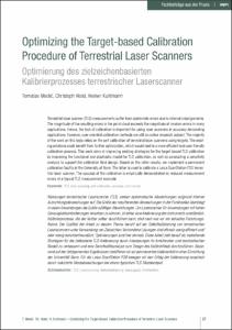
Optimizing the Target-based Calibration Procedure of Terrestrial Laser Scanners: Optimierung des zielzeichenbasierten Kalibrierprozesses terrestrischer Laserscanner
(2020)
Terrestrial laser scanner (TLS) measurements suffer from systematic errors due to internal misalignments. The magnitude of the resulting errors in the point cloud exceeds the magnitude of random errors in many applications. ...
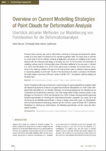
Overview on Current Modelling Strategies of Point Clouds for Deformation Analysis: Überblick aktueller Methoden zur Modellierung von Punktwolken für die Deformationsanalyse
(2016)
Terrestrial laser scanning was used for deformation monitoring of structures and geoscientific objects already at an early stage of its employment for engineering geodetic tasks. This paper gives an overview on current ...
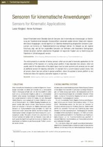
Sensoren für kinematische Anwendungen: Sensors for Kinematic Applications
(2014)
Dieser Artikel bietet einen Überblick über die Sensoren, die in kinematischen Anwendungen zur Bestimmung der Trajektorie einer bewegten Sensorplattform verwendet werden können. Dabei wird insbesondere darauf eingegangen, ...
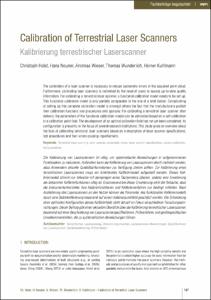
Calibration of Terrestrial Laser Scanners: Kalibrierung terrestrischer Laserscanner
(2016)
The calibration of a laser scanner is necessary to reduce systematic errors in the acquired point cloud. Furthermore, calibrating laser scanners is motivated by the need of users to access up-to-date quality information. ...
Active 3D Reconstruction for Mobile Robots
(2020)
Mapping the environment with the purpose of building a 3D model that represents it, is traditionally achieved by trained personnel, using measuring equipment such as cameras or terrestrial laser scanners. This process is ...