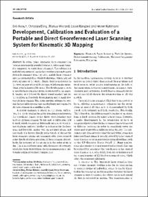
Development, Calibration and Evaluation of a Portable and Direct Georeferenced Laser Scanning System for Kinematic 3D Mapping

Development, Calibration and Evaluation of a Portable and Direct Georeferenced Laser Scanning System for Kinematic 3D Mapping
| dc.contributor.author | Heinz, Erik | |
| dc.contributor.author | Eling, Christian | |
| dc.contributor.author | Wieland, Markus | |
| dc.contributor.author | Klingbeil, Lasse | |
| dc.contributor.author | Kuhlmann, Heiner | |
| dc.date.accessioned | 2019-07-03T07:21:17Z | |
| dc.date.available | 2019-07-03T07:21:17Z | |
| dc.date.issued | 21.01.2016 | |
| dc.identifier.uri | https://hdl.handle.net/20.500.11811/1351 | |
| dc.description.abstract | In recent years, kinematic laser scanning has become increasingly popular because it offers many benefits compared to static laser scanning. The advantages include both saving of time in the georeferencing and a more favorable scanning geometry. Often mobile laser scanning systems are installed on wheeled platforms, which may not reach all parts of the object. Hence, there is an interest in the development of portable systems, which remain operational even in inaccessible areas. The development of such a portable laser scanning system is presented in this paper. It consists of a lightweight direct georeferencing unit for the position and attitude determination and a small low-cost 2D laser scanner. This setup provides advantages over existing portable systems that employ heavy and expensive 3D laser scanners in a profiling mode. A special emphasis is placed on the system calibration, i. e. the determination of the transformation between the coordinate frames of the direct georeferencing unit and the 2D laser scanner. To this end, a calibration field is used, which consists of differently orientated georeferenced planar surfaces, leading to estimates for the lever arms and boresight angles with an accuracy of mm and one-tenth of a degree. Finally, point clouds of the mobile laser scanning system are compared with georeferenced point clouds of a high-precision 3D laser scanner. Accordingly, the accuracy of the system is in the order of cm to dm. This is in good agreement with the expected accuracy, which has been derived from the error propagation of previously estimated variance components. | en |
| dc.format.extent | 17 | |
| dc.language.iso | eng | |
| dc.rights | In Copyright | |
| dc.rights.uri | http://rightsstatements.org/vocab/InC/1.0/ | |
| dc.subject | Kinematic Laser Scanning | |
| dc.subject | Portable System | |
| dc.subject | Direct Georeferencing | |
| dc.subject | Calibration | |
| dc.subject | Variance Component Estimation | |
| dc.subject | Evaluation | |
| dc.subject.ddc | 550 Geowissenschaften | |
| dc.title | Development, Calibration and Evaluation of a Portable and Direct Georeferenced Laser Scanning System for Kinematic 3D Mapping | |
| dc.type | Wissenschaftlicher Artikel | |
| dc.publisher.name | de Gruyter | |
| dc.publisher.location | Berlin | |
| dc.rights.accessRights | openAccess | |
| dc.relation.eissn | 1862-9024 | |
| dcterms.bibliographicCitation.volume | 2015, Bd. 9 | |
| dcterms.bibliographicCitation.issue | 4 | |
| dcterms.bibliographicCitation.pagestart | 227 | |
| dcterms.bibliographicCitation.pageend | 243 | |
| dc.relation.doi | https://doi.org/10.1515/jag-2015-0011 | |
| dcterms.bibliographicCitation.journaltitle | Journal of Applied Geodesy | |
| ulbbn.pubtype | Zweitveröffentlichung |
Dateien zu dieser Ressource
Das Dokument erscheint in:
-
Publikationen (35)
Die folgenden Nutzungsbestimmungen sind mit dieser Ressource verbunden:
