E-Dissertationen: Search
Now showing items 11-19 of 19
Georeferencing of Mobile Mapping Data
(2023-07-06)
One of the main tasks in Engineering Geodesy is the measurement and monitoring of geometry related phenomena on local or regional scales. Examples are the generation of high-resolution 3D city models, as they are needed ...
The Importance of International Quality Standards in Negotiating Trade Agreements between the European Union and Third Countries as regards Global Trade in Agricultural Products and Food
(2023-12-14)
The aim of this thesis is to assess the role of international quality standards in context of free trade agreements, taking into account international supply chains and global value chains. An intensive literature review ...
Strategies for the Empirical Determination of the Stochastic Properties of Terrestrial Laser Scans
(2023-06-28)
Terrestrial laser scanners (TLS) are suitable for the surface approximation of objects and their geometric changes due to the temporally and spatially high-frequent data acquisition. However, precise geodetic engineering ...
Urban Flood Resilience: From Benchmarking Resilience to Accelerating Transformation Using Crowdsourcing Data
(2023-02-23)
This thesis represents a significant contribution to the field of disaster resilience in the context of flood hazards in Iran and Germany. In the face of increasingly unpredictable climate-related extreme events, it is ...
Consistently closing global and regional sea level budgets
(2022-11-17)
Nowadays, human-induced climate change is the major driver of global and regional sea level change threatening the well-being and livelihoods of hundreds of millions of people living close to the coast. Consequently, ...
Thermosphere and radiation effects in forward and inverse non-gravitational force modelling
(2024-02-01)
Precise non-gravitational satellite force models are crucial for various space-based applications, thus contributing to a better understanding of the Earth system.
Satellite orbits are perturbed by gravitational ...
Satellite orbits are perturbed by gravitational ...

Beiträge zur Kalibrierung und Evaluierung von Multisensorsystemen für kinematisches Laserscanning
(2021-01-20)
In den letzten Jahren hat die Nutzung von Multisensorsystemen für
kinematisches Laserscanning zunehmend an Bedeutung gewonnen. Dies zeigt sich
durch die wachsende Anzahl am Markt verfügbarer Systeme und die sich ...
Qualitative and quantitative assessment of sustainable urban stormwater management in Bogotá, Colombia
(2023-10-02)
Rapid population growth and urbanization have triggered abrupt changes in land use, intensifying impervious surfaces and the loss of green areas. Sustainable urban drainage systems (SUDS) are an appealing alternative to ...
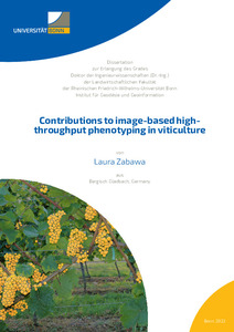
Contributions to image-based high-throughput phenotyping in viticulture
(2023-09-29)
Grapevine is a crop with significant economic importance. Unlike many other crops, grapevine is a quality crop with the focus on yield optimization instead of maximization. Regular monitoring of plant diseases and pests ...