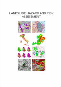
Landslide Hazard and Risk Assessment

Landslide Hazard and Risk Assessment

| dc.contributor.advisor | Dikau, Richard | |
| dc.contributor.author | Guzzetti, Fausto | |
| dc.date.accessioned | 2020-04-08T23:03:59Z | |
| dc.date.available | 2020-04-08T23:03:59Z | |
| dc.date.issued | 2006 | |
| dc.identifier.uri | https://hdl.handle.net/20.500.11811/2644 | |
| dc.description.abstract | Landslides play an important role in the evolution of landforms and represent a serious hazard in many areas of the World. In places, fatalities and economic damage caused by landslides are larger than those caused by other natural hazards, including earthquakes, volcanic eruptions and floods. Due to the extraordinary breadth of the spectrum of landslide phenomena, no single method exists to identify and map landslides, to ascertain landslide hazards, and to evaluate the associated risk. This work contributes to reduce this shortcoming by providing the scientific rationale, a common language, and a set of validated tools for the preparation and the optimal use of landslide maps, landside prediction models, and landslide forecasts. I begin the work by critically analysing landslide inventories, including archive, geomorphological, event and multi-temporal maps. I then present methods to analyse the information shown in the inventories, including the assessment of landslide density and spatial persistence, the completeness of the landslide maps, and the estimation of the recurrence of landslide events, the latter based on historical information obtained from archive or multi-temporal inventories. I then use statistical methods to obtain the frequency-size statistics of landslides, important information for hazard and risk studies. Next, I discuss landslide susceptibility zoning and hazard assessment. I examine statistical and physically-based methods to ascertain landslide susceptibility, and I introduce a scheme for evaluating and ranking the quality of susceptibility assessments. I then introduce a probabilistic model to determine landslide hazard, and I test the model at different spatial scales. Next I show how to determine landslide risk at different scales using a variety of approaches, including probabilistic methods and heuristic geomorphological investigations. Risk evaluation is the ultimate goal of landslide studies aimed at reducing the negative effects of landslide hazards. Lastly, I compare the information content of different landslide cartographic products, including maps, models and forecasts, and I introduce the idea of a landslide protocol, a set of regulations established to link terrain domains shown on the different landslide maps to proper land use rules. I conclude the work by proposing recommendations for the production and optimal use of various landslide cartographic products. The recommendations and most of the results shown in this work are the results of landslide hazard research conducted in central and northern Italy. However, the lessons learned in these areas are general and applicable to other areas in Italy and elsewhere. | en |
| dc.language.iso | eng | |
| dc.rights | In Copyright | |
| dc.rights.uri | http://rightsstatements.org/vocab/InC/1.0/ | |
| dc.subject | Landslide | |
| dc.subject | Map | |
| dc.subject | Hazard | |
| dc.subject | Risk | |
| dc.subject.ddc | 550 Geowissenschaften | |
| dc.title | Landslide Hazard and Risk Assessment | |
| dc.type | Dissertation oder Habilitation | |
| dc.publisher.name | Universitäts- und Landesbibliothek Bonn | |
| dc.publisher.location | Bonn | |
| dc.rights.accessRights | openAccess | |
| dc.identifier.urn | https://nbn-resolving.org/urn:nbn:de:hbz:5N-08175 | |
| ulbbn.pubtype | Erstveröffentlichung | |
| ulbbnediss.affiliation.name | Rheinische Friedrich-Wilhelms-Universität Bonn | |
| ulbbnediss.affiliation.location | Bonn | |
| ulbbnediss.thesis.level | Dissertation | |
| ulbbnediss.dissID | 817 | |
| ulbbnediss.date.accepted | 03.07.2006 | |
| ulbbnediss.fakultaet | Mathematisch-Naturwissenschaftliche Fakultät | |
| dc.contributor.coReferee | Glade, Thomas |
Files in this item
This item appears in the following Collection(s)
-
E-Dissertationen (4369)


