E-Dissertationen: Suche
Anzeige der Dokumente 31-40 von 118
Robust Wide-Baseline Stereo Matching for Sparsely Textured Scenes
(2011-08-19)
The task of wide baseline stereo matching algorithms is to identify corresponding elements in pairs of overlapping images taken from significantly different viewpoints. Such algorithms are a key ingredient to many computer ...
Separablity of deformations and measurement noises of GPS time series with modified Kalman filter for landslide monitoring in real-time
(2011-08-04)
The separation of the deformations and measurement noise of GPS coordinate time series and accuracy improvement of GPS real-time coordinates are major aspects of the thesis. In order to reduce the influence of the colored ...
Automatische Detektion von Krankheiten auf Blättern von Nutzpflanzen
(2011-12-21)
In dieser Arbeit wird ein neuartiges, automatisches Verfahren zur Detektion von Krankheiten auf Blättern von Nutzpflanzen vorgestellt. Die Anwendung von Mustererkennungsverfahren zur Detektion von Blattkrankheiten ist noch ...
Quantitative characterization of solute transport processes in an undisturbed unsaturated soil by means of electrical resistivity tomography (ERT)
(2010-07-27)
Improved understanding of water flow and solute transport through the unsaturated zone is important for the sustainable management of soils. As soils are complex and heterogeneous systems, quantification of the transport ...
Effects on the Geodetic-VLBI Observables Due to Polarization Leakage in the Receivers
(2010-07-01)
Geodetic VLBI delivers baseline length and Earth orientation parameter measurements, which offer the most viable and precise way to study Earth crustal and core dynamics and to support space navigation. The precision of ...
Hydrological Characterization of a Forest Soil Using Electrical Resistivity Tomography
(2010-07-13)
An explicit knowledge of soil properties is required in agronomy, nature conservation, and hydrology to characterize water storage and water flow processes, even more in the context of climate change. Electrical resistivity ...
Zur Teilmarktbildung beim Landerwerb der öffentlichen Hand
(2007)
Die vorliegende Arbeit hat das Ziel, eine Bestandsaufnahme, eine Analyse sowie eine Bewertung der Teilmarkttheorie beim Landerwerb zukünftiger Gemeinbedarfsflächen durchzuführen. Da der Begriff des Teilmarktes nicht normiert ...
Groundwater potential to supply population demand within the Kompienga dam basin in Burkina Faso
(2007)
Groundwater recharge is constrained by various factors with rainfall playing a key role. The Kompienga dam basin located in southeastern Burkina Faso displays semi-arid climatic conditions with rainfall occurring five ...
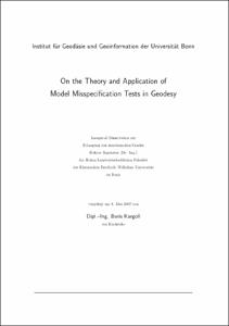
On the theory and application of model misspecification tests in geodesy
(2007)
Many geodetic testing problems concerning parametric hypotheses may be formulated within the framework of testing linear constraints imposed on a linear Gauss-Markov model. Although geodetic standard tests for such problems ...
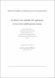
On Monte Carlo methods with applications to the current satellite gravity missions
(2007)
Large-scaled least squares problems require tailored numerical techniques to overcome the computational burden. For these types of problems iterative strategies are suitable because of their flexibility and effectiveness. ...


