E-Dissertationen: Auflistung E-Dissertationen nach Klassifikation (DDC) "ddc:004"
Anzeige der Dokumente 1-20 von 27
-
3D-Stadtmodellierung auf heterogenen Ausgangsmodellen mittels evolutionärer Algorithmen
Weitzig, Björn (2007)Die vorliegende Arbeit beschreibt ein neuartiges Verfahrens zur flexiblen und effizienten 3D-Stadtmodellierung im Kontext der Verfügbarmachung von 3D-Stadtmodellen. Ausgangspunkt ist die Heterogenität existierender und ... -
Algebraic, logical and stochastic reasoning for the automatic prediction of 3d building structures
Loch-Dehbi, Sandra (2021-01-26)3D building models are nowadays an important prerequisite for many applications such as rescue management or navigation tasks. However, most approaches for the automatic reconstruction of buildings rely on high-resolution ... -
Attributierte Grammatiken zur Rekonstruktion und Interpretation von Fassaden
Schmittwilken, Jörg (2012-03-19)Dem Bedarf und Nutzen hoch detaillierter 3D-Stadt- und Gebäudemodelle steht deren aufwendige Erfassung gegenüber. Ist die automatische Ableitung vereinfachter Dachstrukturen aus Luftbildern oder Laseraltimetrie weitestgehend ... -
Automatische Detektion von Krankheiten auf Blättern von Nutzpflanzen
Bauer, Sabine Daniela (2011-12-21)In dieser Arbeit wird ein neuartiges, automatisches Verfahren zur Detektion von Krankheiten auf Blättern von Nutzpflanzen vorgestellt. Die Anwendung von Mustererkennungsverfahren zur Detektion von Blattkrankheiten ist noch ... -
Beschriftung von Bildschirmkarten in Echtzeit: Konzept und Struktur
Petzold, Ingo (2003)Diese Arbeit stellt neuartige Konzepte zur Beschriftung von punkt-, linien- und flächenhaften Objekten in Karten vor. Der Fokus liegt dabei auf Bildschirmkarten. Im Unterschied zu traditionellen Papierkarten müssen für ... -
Collaborative Working Environments: Group Needs Approach to Designing Systems for Supporting Spatially Distributed Groups
Pankiewicz, Maciej Władysław (2011-02-24)Collaboration in spatially distributed groups requires technological support for mediating collaborative activities and members’ interactions over time and distance. Technology provides multiple tools for supporting ... -
Exact Optimization Algorithms for the Aggregation of Spatial Data
Oehrlein, Johannes (2020-12-16)The aggregation of spatial data is a recurring problem in geoinformation science. Aggregating data means subsuming multiple pieces of information into a less complex representation. It is pursued for various reasons, like ... -
Extrinsic Calibration and Ego-Motion Estimation for Mobile Multi-Sensor Systems
Huang, Kaihong (2018-12-20)Autonomous robots and vehicles are often equipped with multiple sensors to perform vital tasks such as localization or mapping. The joint system of various sensors with different sensing modalities can often provide better ... -
Geometrische Generalisierung von Digitalen Höhenmodellen
Braunmandl, Andre (2003)Die Bedeutung digitaler Informationsträger bei der Bearbeitung kartographischer Fragestellungen wächst zunehmend. Um den damit ebenfalls wachsenden Anforderungen zu genügen, sind Konzepte zu entwickeln, die die Besonderheiten ... -
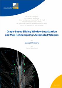
Graph-based Sliding Window Localization and Map Refinement for Automated Vehicles
Wilbers, Daniel (2021-10-12)Localization is an essential task in automated driving and advanced driver assistance systems. The precise location of a vehicle is required for extracting information from a map about the vehicle's environment. The map ... -
Grouping Uncertain Oriented Projective Geometric Entities with Application to Automatic Building Reconstruction
Beder, Christian (2007)The fully automatic reconstruction of 3d scenes from a set of 2d images has always been a key issue in photogrammetry and computer vision and has not been solved satisfactory so far. Most of the current approaches match ... -
Hierarchical and Spatial Structures for Interpreting Images of Man-made Scenes Using Graphical Models
Yang, Michael Ying (2012-02-02)The task of semantic scene interpretation is to label the regions of an image and their relations into meaningful classes. Such task is a key ingredient to many computer vision applications, including object recognition, ... -
Ein hierarchischer Ansatz zur Interpretation von Gebäudeaufnahmen
Drauschke, Martin (2012-06-20)Durch die Fortschritte bei der 3D-Visualisierung von Landschaften und urbanen Räumen in den vergangenen Jahren wächst die Nachfrage nach semantischen und detailgenauen 3D-Stadtmodellen. Die Interpretation von Digitalbildern ... -
Methodische Probleme bei der Erstellung von Unkrautverteilungskarten mit Geoinformationssystemen (GIS)
Backes, Matthias Bernhard (2005)Die vorliegende Arbeit befaßt sich mit den methodischen Problemen, die bei der Erstellung von Unkrautverteilungskarten mit Geoinformationssystemen (GIS) auftreten können. Im Vordergrund steht dabei die Frage nach der ... -
Plant Classification Systems for Agricultural Robots
Lottes, Philipp (2021-03-16)Due to a continually growing world population, the demand for food and energy increases continuously. As a central source of food, feed, and energy, crop production is therefore called upon to produce higher yields. To ... -
Resilience, collapse and reorganization of a rangeland socio-ecological system in South Africa
Rasch, Sebastian (2016-05-24)Communal rangelands in semi-arid areas are complex socio-ecological systems (SES). Their complexity arises from non-linear feedbacks between the social- and the ecosystem. To understand the social system requires tackling ... -
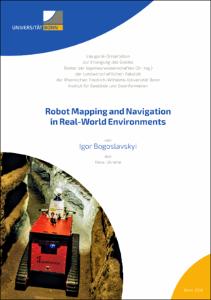
Robot Mapping and Navigation in Real-World Environments
Bogoslavskyi, Igor (2018-11-27)Robots can perform various tasks, such as mapping hazardous sites, taking part in search-and-rescue scenarios, or delivering goods and people. Robots operating in the real world face many challenges on the way to the ... -
Robot Mapping with 3D LiDARs
Vizzo, Ignacio Martin (2024-05-15)Robots can assist humans in a multitude of ways. For example, robots can handle tedious tasks that humans prefer not to do, such as vacuum cleaning daily to keep a house clean. They can tackle challenging problems that, ... -
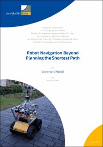
Robot Navigation Beyond Planning the Shortest Path
Nardi, Lorenzo (2021-04-16)Over the last decade, the demand for autonomous mobile robots has been growing continuously. Applications range from mobile manipulators operating on factory floors to autonomous cars driving in urban environments. A common ... -
Robust Wide-Baseline Stereo Matching for Sparsely Textured Scenes
Dickscheid, Timo (2011-08-19)The task of wide baseline stereo matching algorithms is to identify corresponding elements in pairs of overlapping images taken from significantly different viewpoints. Such algorithms are a key ingredient to many computer ...


