Schriftenreihe des Instituts für Geodäsie und Geoinformation: Browsing Schriftenreihe des Instituts für Geodäsie und Geoinformation by Title
Now showing items 8-27 of 69
-
Assessing people´s early warning response capability to inform urban planning interventions to reduce vulnerability to tsunamis: case study of Padang City, Indonesia
(2014)In the last decade, more emphasis is given on the human aspect of early warning or the attribute of “people-centered” early warning systems. This study seeks to better understand the specific conditions that shape people´s ... -
Atmospheric refraction and turbulence in VLBI data analysis
(2018)The progress in further improving the quality of results derived by space-geodetic techniques observing in the radio frequency domain, such as Very Long Baseline Interferometry (VLBI) or Global Navigation Satellite Systems ... -
Attributierte Grammatiken zur Rekonstruktion und Interpretation von Fassaden
(2012)Dem Bedarf und Nutzen hoch detaillierter 3D-Stadt- und Gebäudemodelle steht deren aufwendige Erfassung gegenüber. Ist die automatische Ableitung vereinfachter Dachstrukturen aus Luftbildern oder Laseraltimetrie weitestgehend ... -
Auswirkungen von Flughäfen insbesondere von Fluglärm auf den Immobilienmarkt am Beispiel des Marktsegments „individuelles Wohnen“
(2011)Mit der in den letzten Jahren deutlich angestiegenen Zahl von Flugbewegungen und der engen räumlichen Verzahnung zwischen Flughafenstandorten und Siedlungsflächen werden die Diskussionen über negative Auswirkungen von ... -
Automatische Detektion von Krankheiten auf Blättern von Nutzpflanzen
(2013)In dieser Arbeit wird ein neuartiges, automatisches Verfahren zur Detektion von Krankheiten auf Blättern von Nutzpflanzen vorgestellt. Die Anwendung von Mustererkennungsverfahren zur Detektion von Blattkrankheiten ist noch ... -
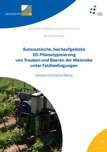
Automatische, hochaufgelöste 3D-Phänotypisierung von Trauben und Beeren der Weinrebe unter Feldbedingungen
(2020)<em>Pilzwiderstandsfähige Sorten (PIWI) </em>sind eine der Innovationen im Weinbau. Das Projekt <em>Novel Viticulture Systems for sustainable production and products (NoViSys)</em> kombiniert die PIWIs zur Effizienzsteigerung ... -
Ein Beitrag zur koordinatengesteuerten Aussaat von Rübenpflanzen mittels Multi-Sensor-System und Filteransatz
(2012)Die Bestandspflege von landwirtschaftlichen Kulturen, maßgeblich geprägt durch die Unkrautkontrolle, wird heutzutage überwiegend mit chemischen Pflanzenschutzmitteln betrieben. Der gestiegene Bedarf an Bioprodukten erfordert ... -
Brachflächenrevitalisierung im Rahmen der Flächenkreislaufwirtschaft
(2009)In Deutschland wird eine nachhaltige Siedlungspolitik verfolgt, die einen sparsamen Umgang mit Grund und Boden in sozialverträglicher und ökologischer Flächennutzung vorsieht. Daher hat die Bundesregierung sich zur ... -
Conceptualizing the concept of disaster resilience: a hybrid approach in the context of earthquake hazard: case study of Tehran City , Iran
(2017)From the natural perspective, disaster resilience is defined as the ability of a system or community to resist, mitigate, respond, and recover from the effects of hazards in efficient and timely manner. How urban communities ... -
Convex optimization for inequality constrained adjustment problems
(2015)Whenever a certain function shall be minimized (e.g., a sum of squared residuals) or maximized (e.g., profit) optimization methods are applied. If in addition prior knowledge about some of the parameters can be expressed ... -
Determination of sub-daily earth rotation parameters from VLBI observations
(2015)The work presented deals with the determination of sub-daily Earth Rotation Parameters (ERPs) from Very Long Baseline Interferometry (VLBI) observations. Monitoring and interpreting the Earth's rotation variations in general ... -
Development of a one-step 3D approach for the phase unwrapping process in a D-InSAR stack based on SBAS interferograms
(2020)Differential Interferometric Synthetic Aperture Radar (D-InSAR) is a unique technique to detect and map deformations of the Earth's surface over large temporal and spatial scales. Processing a whole stack of multitemporal ... -
Digital filtering algorithms for decorrelation within large least squares problems
(2012)The GOCE (Gravity Field and steady-state Ocean Circulation Explorer) mission is dedicated to the determination of the Earth's gravity field. During the mission period of at least one year the GOCE satellite will collect ... -
Effects on the Geodetic-VLBI Observables Due to Polarization Leakage in the Receivers
(2011)Geodetic VLBI delivers baseline length and Earth orientation parameter measurements, which offer the most viable and precise way to study Earth crustal and core dynamics and to support space navigation. The precision of ... -
Entwicklung einer direkten Georeferenzierungseinheit zur Positionsund Orientierungsbestimmung leichter UAVs in Echtzeit
(2016)Seit einigen Jahren werden im Bereich der Geodäsie immer häufiger auch Unmanned Aerial Vehicles (UAVs) als kinematische Trägerplattformen eingesetzt. Dazu werden diese mit objekterfassender Sensorik, wie z.B. Digitalkameras ... -
Entwicklung eines Kalman-Filters zur Bestimmung kurzzeitiger Variationen des Erdschwerefeldes aus Daten der Satellitenmission GRACE
(2011)Eine wichtige Beobachtungsgröße bei der Erforschung des Erdsystems stellt das Gravitationsfeld der Erde dar, dessen zeitliche Variationen mit der Satellitenmission GRACE (Gravity Recovery And Climate Experiment) erstmals ... -
Entwicklungsperspektiven metropolitaner Peripherien im Rahmen stadtregionaler Planungs- und Entwicklungsprozesse am Beispiel Nordrhein-Westfalen
(2013)Die zurückliegenden Dekaden haben sich durch eine enorme Zunahme der Entwicklungsdynamiken von gesellschaftlichen, ökonomischen und ökologischen und daraus hervorgehend räumlichen Entwicklungen charakterisiert. Ein prägnantes ... -
Exploring urban structure to approach energy optimization: The case of residential settlement development in Dhaka city, Bangladesh
(2017)The concept of energy optimization in urban development has the potential to address many urban challenges besides local energy concerns. Past research has attempted to combine the cross-cutting issues of urban planning, ... -
Extrinsic Calibration and Ego-Motion Estimation for Mobile Multi-Sensor Systems
(2020)Autonomous robots and vehicles are often equipped with multiple sensors to perform vital tasks such as localization or mapping. The joint system of various sensors with different sensing modalities can often provide better ... -
Finding spectral features for the early indentification of biotic stress in plants
(2013)Early detection of biotic stress in plants is vital for precision crop protection, but hard to achieve. Prediction of plant diseases or weeds at an early stage has significant influence on the extent and effectiveness of ...